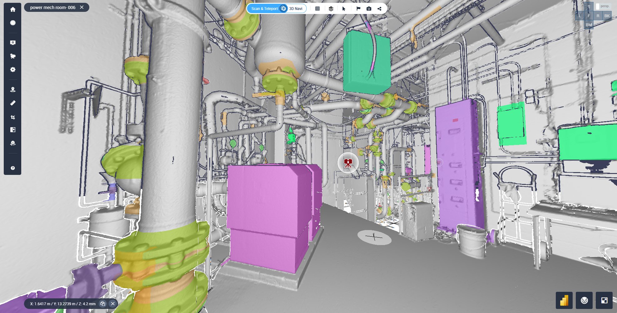
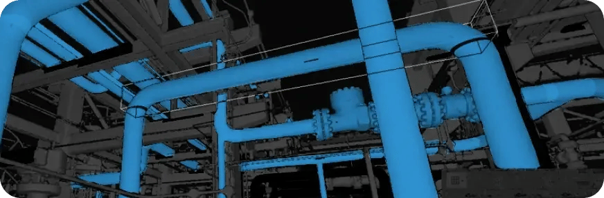
Manage all 3D scan data in a central hub, including integration-based data for scan to BIM/CAD workflows. Diversify your toolset options to perform crops and comparisons seamlessly, all powered by Cintoo’s TurboMesh engine which converts point cloud data to high-fidelity 3D meshes.
The use of laser scanning is becoming a vital part of most construction, manufacturing, and energy project workflows, representing the need to combine as-built scan data with BIM (Building Information Modelling) and digital twin workflows. Valued at $3.72 billion in 2020, the global 3D scanning market size is projected to reach $16.66 billion by 2030, registering a CAGR of 16.3% from 2021 to 2030.*
Laser scanning reduces survey time by up to 50% compared to traditional methods. Its precision minimizes human error and creates highly accurate as-built documentation, making it essential for renovation and maintenance projects. 13 Benefits of Laser Scanning in Construction - BuilderSpace.
Now, laser scanning represents the first step in creating 3D data synergy, where all information works together to streamline BIM/CAD and digital twin workflows. Enhance your project from start to finish, whether it’s to build new, perform a rework, renovate a site, conduct maintenance, or digitally monitor the lifecycle of equipment and other site aspects. In this eBook, learn how you can maximize ROI, enhance collaboration across teams, and speed up project delivery without risk.

First, a project manager or coordinator will determine the goals for laser scanning, such as creating as-built models, monitoring progress, or ensuring quality control. The areas to be scanned and the data needed, including level of detail and accuracy, will also be determined. Even types of scanners may be discussed at this phase. Choosing a laser scanner depends on many different elements, including the type of environment, such as indoor and outdoor. A range of scanners can be evaluated, including mobile, terrestrial and drone scanners.
A project team needs to ensure the site is accessible and clear for accurate scanning. Once the area is cleared, scanning takes place. Technicians use 3D laser scanners to capture millions of data points, converted into point clouds, across the construction site. But this may lead to challenges after laser scanning has wrapped up. It may cause a project manager to ask themselves what happens afterwards, considering the huge amount of data they’ve now acquired.
Once point cloud data is collected from a variety of laser scanners, it needs to be consolidated in one centralized place in order to view and share with others. However, this can be tricky to facilitate well as point cloud data is extremely large and hard to manage. One can use a variety of platforms for condensing point cloud data into 3D meshes, which optimizes viewing and navigation for ease of use and collaboration. At this point in the laser scanning process, team members and coordinators might also be interested in integrating BIM/CAD models into their workflows to run easy comparison and make sure the project is on time and aligned.
Finally, analysis and application includes all aspects of optimizing your use of 3D laser scan data and creating 3D scan data synergy. Apply toolsets into your workflows once the data is centralized in an all-in-one platform. These tools include automatic measurements, annotating, progress monitoring and issue tracking, asset management, and BIM/CAD model comparisons. Creating 3D data synergy means that you and your team are equipped to make smarter decisions, enhance collaboration, and improve project outcomes.
“Cintoo has really bridged that gap for us. It’s taken scan data from an expert-only application and made it usable by the masses. Cintoo is just a phenomenal platform.”
John Brown,
Head of Reality Capture, GM
Managing Large File Sizes
Condensing massive laser scan data files without compromising quality remains a challenge, especially when sharing with internal and external stakeholders.
Interpreting and Navigating 3D Scan Data
Viewing and analyzing complex 3D scan data can be difficult, requiring intuitive tools that enhance accessibility and usability.
Data Silos
A no-silo approach is critical, but achieving seamless collaboration requires prioritizing web-centric solutions that facilitate cross-team access and integration.
Ensuring Data Security at Scale
With large scan files being shared across multiple teams, maintaining robust cybersecurity and access control measures is essential.
Balancing Access and Usability
Providing secure yet user-friendly access to key areas of a project for all stakeholders—regardless of technical expertise—can be difficult.
Tracking and Documenting Changes Effectively
Confirming reviews, approvals, and ad-hoc notes across teams without losing critical details demands an efficient, built-in documentation process.
Streamlining As-Built Comparisons
Accurately comparing scan data with as-built conditions requires easy-to-use tools, automated measurements, and annotations that simplify workflows.
Vendor Lock-In
Being tied to a specific laser scanner vendor can limit flexibility, making it challenging to merge scan data from different sources (static, mobile, and drone) into a single project.
Making 3D Data Intuitive for All Users
The complexity of 3D scan data can be a barrier for non-technical users, highlighting the need for a platform that is as intuitive as it is powerful.
“Cintoo has exceeded what we originally wanted it to do. It has become a vital part of our point cloud management and we get value out of it every day.”
Arup
Leverage advanced compression and cloud-based streaming to condense massive laser scan data files, ensuring seamless sharing with internal and external stakeholders without loss of quality.
In your web-based solution, use visualization tools that simplify the viewing, interpretation, and navigation of complex 3D scan data for all users.
Adopt a fully web-centric platform that enables real-time collaboration, cross-team accessibility, and seamless integration with other enterprise systems.
Utilize enterprise-grade encryption, role-based access control, and secure cloud hosting to protect sensitive scan data while ensuring authorized access
Provide a flexible, link-based access system that allows users to interact with key project areas effortlessly, regardless of their technical expertise.
Integrate built-in tracking features to confirm approvals, capture ad-hoc notes, and document changes in a structured, easily accessible format.
Offer a robust suite of automated measurement tools, annotations, and AI-driven comparison features to streamline the validation of scan data against as-built conditions.
Support interoperability with all major laser scanners and 3D data sources (static, mobile, and drone) to enable seamless data merging within a single project.
Develop an easy-to-use interface with guided workflows and smart automation, ensuring that both technical and non-technical users can engage effectively with 3D scan data.
“Cintoo is an intrinsic part of how we collaborate with stakeholders and demonstrate value to our clients.”
Stantec
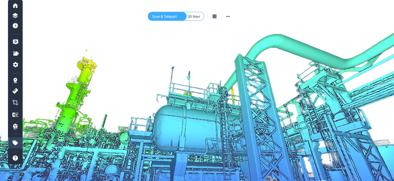
Cintoo can process a wide range of laser scan data, whether from static, mobile, or drone scanners. Cintoo's hardware agnosticism means that there is no limitation on the types of unstructured and structured data you choose to import. Cintoo will automatically restructure point cloud data so that you can experience it as though it has come from a static scanner, including 360° panoramas. Mesh-based scan data becomes 10 to 20 times smaller in size and has the same resolution and accuracy as the source point clouds-you're never compromising on visualization or actionability in Cintoo.
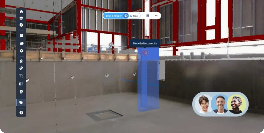
Manage all 3D scan data in a central hub, including integration-based data for scan to BIM/CAD workflows. Diversify your toolset options to perform crops and comparisons seamlessly, all powered by Cintoo’s TurboMesh engine which converts point cloud data to high-fidelity 3D meshes.
Analyze your site and site conditions, including facility aspects and equipment pieces. Use annotations to track notes and share with other team members. Perform automatic measurements accurately and at-scale.
Use progress monitoring to enhance stakeholder communication and ensure better, data-driven decision-making. Use Cintoo’s built-in issue tracking to help identify and address problems early, reducing the risk of costly delays and rework. Streamlined documentation and assignment tools ensure quick resolution that keeps projects on track and within budget.
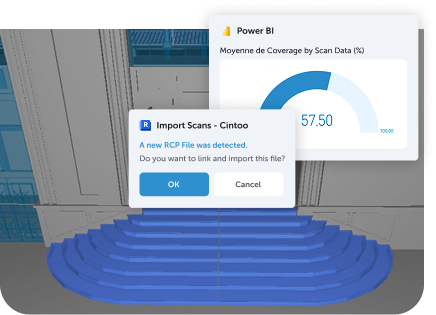
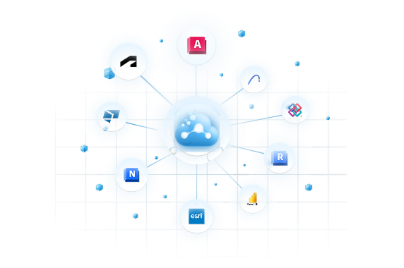
Plug in any integrations into Cintoo, including Autodesk Construction Cloud, BIM 360, BIM Track, Procore, and other scanner-based offerings, including Navvis and Revit. Don’t get locked into only one vendor option. Plus, use the Cintoo Experience Builder Widget in your enterprise Esri ArcGIS account, bringing 3D scan data right into your geospatial projects.
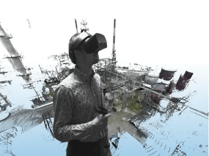
Discover how an industrial metaverse experience can enhance use cases that require a high level of collaboration, simulation, and interaction.
The Cintoo Custom Branding is an option for customers who have specific requirements in terms of branding and security.
Sharing & Collaboration
Analyze your site and site conditions, including facility aspects and equipment pieces. Use annotations to track notes and share with other team members. Perform automatic measurements accurately and at-scale.
AI-Driven Asset Management
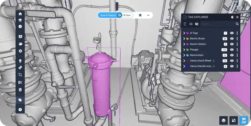
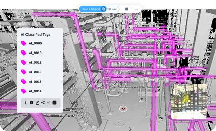
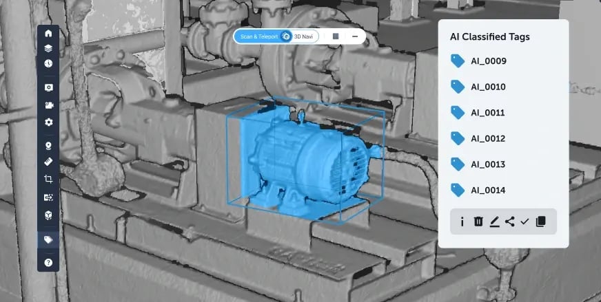
Cintoo’s AI‑driven asset management capabilities enable teams to automatically identify, geolocate, and classify assets directly within high‑fidelity scan data, creating a reliable as‑built foundation for digital twins and asset workflows. By leveraging an AI engine tailored for industrial and built‑environment use cases, organizations can rapidly catalog equipment and ensure asset information is complete, accurate, and aligned with real‑world conditions. This approach reduces manual effort, improves consistency, and allows asset intelligence to scale across projects and facilities with confidence.
Connected Metadata
Connected metadata in Cintoo allows asset tags to carry rich, customizable information such as IDs, specifications, documentation links, and connections to ERP, EAM, Digital Twin, or IoT systems, directly within the 3D environment.
This ensures that critical information is always accessible in context, rather than disconnected or siloed. By maintaining an open and extensible tag data model, Cintoo enables metadata to evolve alongside assets and integrate seamlessly into broader enterprise workflows. Now, with Cintoo’s P&ID explorer, teams can also bring 2D drawings and documentation into 3D context, providing side by side comparisons, analysis and asset tagging.
360 in 3D
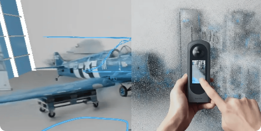
Start anywhere with 360 inside 3D. Unify 360 videos inside the 3D environment with no split screens. Using Ricoh’s THETA X camera, discover a cloud-to-cloud connected solution where 360 videos are automatically uploaded to your Cintoo project and can be manually aligned to the 3D context. This unified approach combines the simplicity of lightweight 360 capture with the rigor of high‑fidelity 3D workflows, giving all stakeholders an easy-to-use and cost-effective solution.
The development of Cintoo’s core technology began in July 2013 with 3 PhDs. The goal was to find a new method to manage massive point clouds efficiently via the cloud, leveraging streaming and compression algorithms. This core technology was later embedded in Cintoo, which was first released in late 2018.
Now, Cintoo is prepared to enter their boldest year of development yet with iterations on progress monitoring, site map navigation, the Cintoo Metaverse, and more. With new innovations, Cintoo is transforming how large manufacturing and construction companies innovate and collaborate across their reality capture and digital twin workflows.
The Twin Edition of the Cintoo platform is built for the demands of Industry 4.0, empowering teams in manufacturing, energy, and process facilities to manage complex environments with precision. Perform virtual site visits, streamline global collaboration, and maintain a single source of truth with a high-fidelity digital twin. Navigate to any virtual vantage point, install new assets, and manage asset lifecycles using AI-powered asset tagging. The Twin Edition enhances safety, reduces waste, and improves performance—putting your team in control of even the most complex facilities.
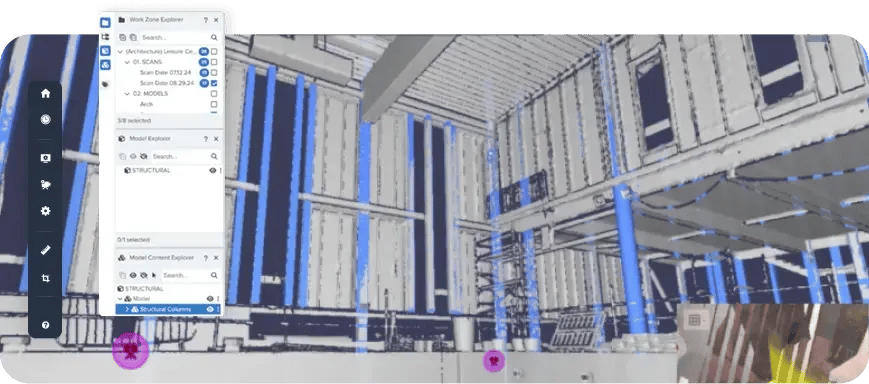
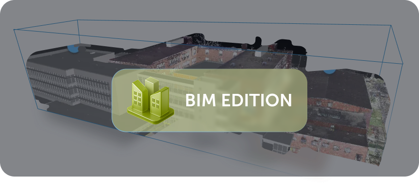
Manage your reality capture data and enable scan-to- BIM workflows, no matter how large or small your projects are, in the Cintoo platform. The BIM Edition is designed for AEC-centric workflows, making it easier than ever to upload and compare BIM and CAD models to 3D scan data. Use progress monitoring to populate quantitative data and analysis and spot discrepancies early, while integrated issue tracking helps eliminate risks before they escalate.
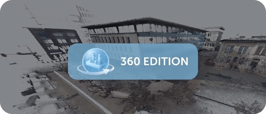
The 360 Edition expands Cintoo’s multimodality with lightweight, easy‑to‑use reality capture, allowing teams to capture, import, align, and navigate Ricoh‑native 360 videos directly inside existing 3D workflows. By bringing 360 captures into the same synchronized 3D environment as scans and BIM models without split screens, teams gain faster site understanding, broader coverage at lower cost, and full access to measurement, annotation, and collaboration tools, making it easy to start anywhere and expand reality capture across projects and sites.
“In addition to avoiding project downtime, Cintoo has enabled the design team to virtually walk through sites, saving us thousands of dollars on tasks such as replacing a flow meter or determining dimensions for replacement. Our designers can model a solution easily and efficiently in Cintoo.”
BP